Program
Tutorial: 22 October 2024 (am)
Collecting data in the field with free & open source geospatial tools: QGIS, QField, and Mergin Maps
Presenters: John Bryant, Grant Boxer, John Duncan
Duration: 3 hours (plus a break for morning tea)
More information
In recent years, not one, but two excellent QGIS-based mobile apps for field geospatial data collection have gained a large following: QField and Mergin Maps. Both apps are free & open source and can function entirely offline, with cloud-based utilities for syncing field data to a central location.
In this tutorial, we'll:
- 1. walk through the process for setting up a data collection project in QGIS, with offline base maps, the ability to capture photos, and field-friendly data capture forms with dropdown lists, constraints, and real-time data validation
- 2. get some fresh air, taking our project into the field with a brief walk around Esplanade Park in Fremantle
- 3. return to our home base, where we'll sync our field data on a cloud platform.
Participants are asked to bring a laptop with a recent version of QGIS, and a mobile device (we'll install Mergin Maps at the workshop, if you don't already have it). We'll get in touch in advance to provide further details.
Conference Day: 23 October 2024
Schedule
Keynote Speakers
In collaboration with ISPRS, FOSS4G Perth is hosting two keynote speakers:
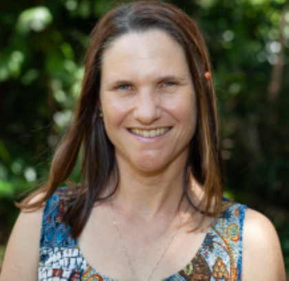
Karen Joyce
A biographer for Mother Earth, using satellites and drones as my scientific illustratorsI share my experiences drawn from 25 years as a geospatial scientist in academia, military, industry, and small business to help people discover science beyond lab coats and test tubes. But I have an ulterior motive. I am passionate about how we can use drones and geospatial technology to watch over our environment and its changes. So the more people I can inspire to join me, the faster we can put plans in place to help keep our environment healthy into the future.
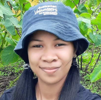
Ahi Saipaia
From Paddock to Polygon: co-development of open-source geospatial applications and workflows for mapping diverse cropping systems in the PacificAhi is the lead Technical Officer for the Ministry of Agriculture, Food, Forests and Fisheries (MAFFF), Tonga. Ahi was a technical expert on an Australian Centre for International Agricultural Research (ACIAR) funded project using open-source geospatial applications to map and monitor Tonga’s diverse agricultural landscapes. Since the project’s end, she has assumed a lead technical role with MAFFF overseeing multiple nation wide crop surveys and agricultural mapping initiatives, resulting in one of the South Pacific’s most detailed and temporally consistent agricultural datasets.
Invited Speakers
FOSS4G Perth welcomes special guest speakers Andrew Dowding & Tim Cable from Winyama.
Empowering Indigenous Communities with GIS: Micro-credentialing for First Nations Land Management
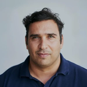
Andrew Dowding
Andrew’s role is to manage and guide Winyama, create opportunities for the team to grow into their roles and most importantly to generate work for the organisation to be sustainable. Andrew is from the Ngarluma traditional owner group and grew up between Perth, Sydney, and the Pilbara. Andrew’s passion is Indigenous mapping and the use of technology for cultural safeguarding. He co-founded Winyama in 2018 to provide more opportunity for Indigenous people to work in the geospatial industry and within the broader digital economy.
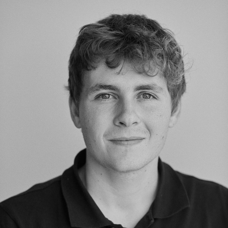
Tim Cable
Born and raised in Perth, Wilman Noongar man, Tim is a versatile and experienced Senior IT consultant with a passion for innovation and client satisfaction. As a Contracted Cloud Solutions Architect, Developer, IT Systems Consultant, and Systems Administrator, Tim thrives in dynamic, client-facing environments. Tim brings a wealth of experience in IT Managed Services, handling pressure with grace. He manages multiple clients and projects effortlessly, showing adaptability and a knack for learning quickly. Tim's dedication to giving back is evident in his volunteer work, reflecting his desire to make a positive difference.
Presentations
Social Event
At the end of the day, we'll kick off a fun social evening for registered FOSS4G and ISPRS attendees.
We'll head to classic Freo venue Beerpourium to wind down, play foosball/pool/lawn bowls, and enjoy the warm glow of our wonderful geospatial community.
We look forward to seeing you there :)